Second Baptist Church, Richmond Heights
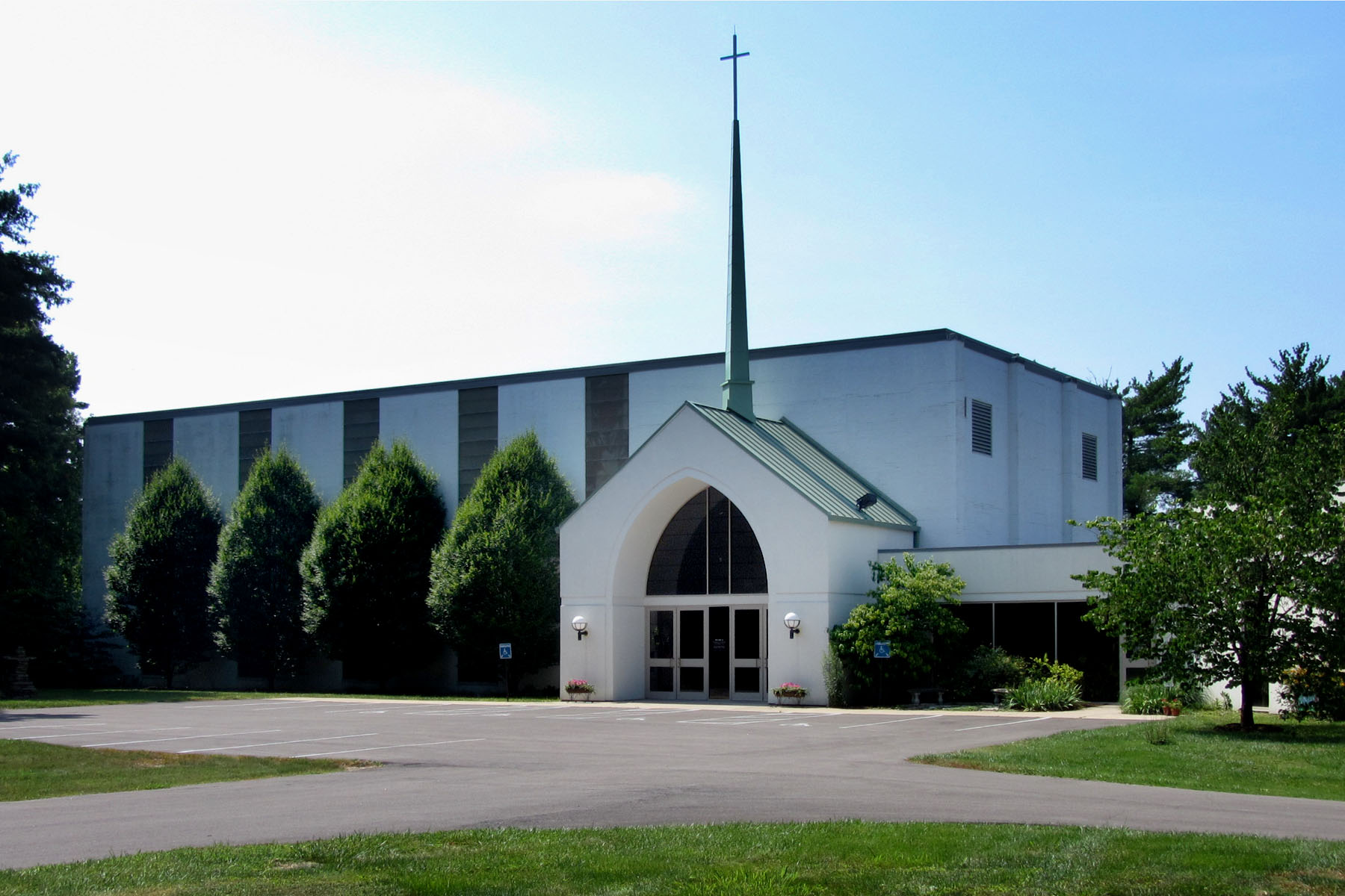
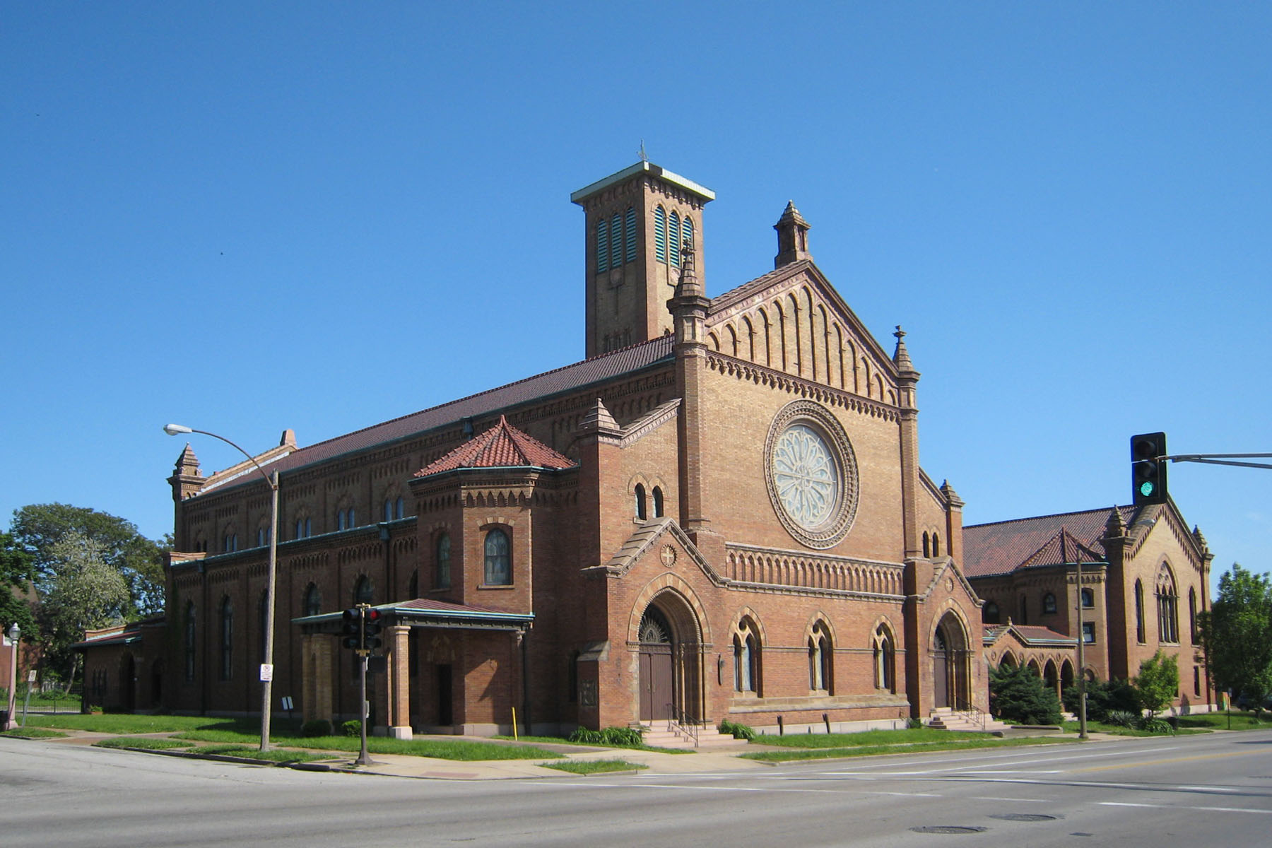
Genealogical DataThe following records from this congregation are available: Names associated with the church, 1833–1908 The material was contributed by Ruth Laper, of St. Peters, Illinois, for the St. Louis Genealogical Society Quarterly, volume 6, number 4, pages 79–85. HistoryEstablished 1833; still active in 2016 In the early nineteenth century, a Baptist church that welcomed both white and African American parishioners was formed in St. Louis. This small group struggled with the discriminatory laws of the time and eventually, in 1828, the black members left to form their own congregation. The white members continued to worship but their numbers dwindled due to disease and the condemnation of their original building. By 1833, the members voted to dissolve their original congregation and re-form as the Second Baptist Church. Over the course of their history, this congregation has worshiped at five different locations. They merged with North Baptist Church in 1872 and built a new church on the northwest corner of Locust and Beaumont Streets in St. Louis. In 1874, a fire destroyed that church. The congregation met temporarily at Shaare Emeth Temple until they rebuilt a new church. In 1907, they built a stunning, modern structure on Kingshighway Boulevard in the Central West End of St. Louis City. This building was located in an area called “Holy Corners,” and the structure, which the church left in 1955, is now part of the National Register Historic District. As population continued to move westward in the mid-twentieth century, the congregation headed into Richmond Heights in St. Louis County. Initially, they met in an historic mansion located on the southeast corner of Clayton Road and McKnight before erecting a small church building in 1958. |
|
|
The congregation enlarged the church building in 1985. In 2002, the congregation demolished the nearby original historic mansion first used when they moved to this site in order to complete a new major addition. Address: 9030 Clayton Road, Richmond Heights, Missouri 63117 Telephone: 314-991-3424 Website: www.2ndbc.org/ GPS (Latitude, Longitude): 38.6389153,-90.3579082 View Map Location 1839–1847: Third and Chestnut Streets, St. Louis, Missouri 63102 GPS (Latitude, Longitude): 38.625628, -90.187277 View Map Location 1847–1872: Sixth and Locust Streets, St. Louis, Missouri 63101 GPS (Latitude, Longitude): 38.6287824,-90.1920599 View Map Location 1872–1908: Locust and Beaumont Streets, St. Louis, Missouri 63103 GPS (Latitude, Longitude): 38.634796, -90.216329 View Map Location 1908–1954: 500 N. Kingshighway Boulevard, St. Louis, Missouri 63108 GPS (Latitude, Longitude): 38.650052,-90.2655307 View Map Location 1954–Present: 9030 Clayton Road, Richmond Heights, Missouri 63117 GPS (Latitude, Longitude): 38.6389153,-90.3579082 View Map |
|
Last Modified: 30-Aug-2022 11:32

